
May 23, 2025
AP Sensing Shares Expert Perspective on Solar Fire Risks in Industry Feature
As the global shift toward renewable energy accelerates, fire detection in photovoltaic installations is gaining new urgency.
May 21, 2025
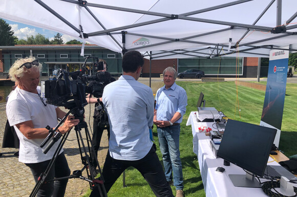
Live Demo at the National Cybersecurity Conference
AP Sensing took part in a high-profile event at the Hasso Plattner Institute in Potsdam, dedicated to the protection of critical infrastructure.

May 19, 2025
Enhancing Subsea Infrastructure Monitoring with Fiber Optic Sensing
Subsea infrastructure is playing an increasingly important role—both in energy transmission and global data communication. These cables and pipelines span vast distances, cross environmentally sensitive marine areas, and often lie buried in deep, hard-to-access parts of the seabed. This makes reliable, continuous monitoring essential—ideally in real time and without the need for physical inspection.

May 1, 2025
Enhancing Coastal Infrastructure Protection with DAS
At the UDT 2025 conference in Oslo, Dr. Bernd Drapp was honored with the Best Newcomer Award for bringing a new perspective to the field on how Distributed Acoustic Sensing (DAS) enhances the protection of critical subsea infrastructure.

Apr 25, 2025
AP Sensing Supports Earthquake Relief in Myanmar
Following the devastating earthquakes that struck central Myanmar in late March, AP Sensing has donated to CARE to support emergency relief efforts in the region.

Apr 7, 2025
Listening Beneath the Waves: Protecting Subsea Cables with Fiber Optic Sensing
Critical Underwater Infrastructure (CUI) such as telecommunications or power cables as well as pipelines are essential to global connectivity, yet they remain vulnerable to damage, both accidental and intentional.

Mar 27, 2025
AP Sensing: Brand Relaunch
At AP Sensing, we’re driven by collaboration, innovation, and reliability. As we continue to evolve, we’re excited to introduce our refreshed corporate design.

Mar 27, 2025
Enhancing Fire Safety on RoRo Ships with Fiber Optic Linear Heat Detection
AP Sensing's fiber optic LHD system was evaluated to improve fire detection methods in open and enclosed RoRo spaces.

Mar 27, 2025
Optical Fault Location and Temperature Monitoring of a 220 kV Power Cable
The Horns Rev 3 offshore wind farm, located off the west coast of Denmark, has a maximum installed power capacity of 400 MW. They chose AP Sensing for our unique combination of Distributed Temperature Sensing (DTS) and Distributed Acoustic Sensing (DAS) capabilities.

Mar 27, 2025
Advanced Long-Range Submarine Power Cable Monitoring
AP Sensing deployed two Distributed Acoustic Sensing (DAS) instruments to monitor the interconnector, delivering comprehensive and real-time insights into the cable’s condition.
Mar 27, 2025
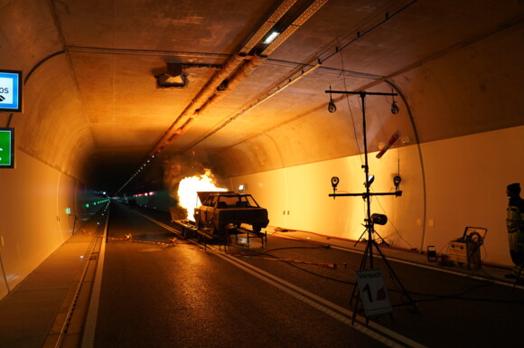
Seconds Matter: LHD Protects Traffic Tunnel
To address these challenges, the tunnel operator had two AP Sensing N45 Linear Heat Detection (LHD) systems installed. The Ø 4 mm sensor cable with its two independent fibers is routed along the tunnel ceiling.

Mar 27, 2025
Subsea Power Cable Monitoring with SmartVision and RTTR
The AP Sensing softwares - SmartVision and RTTR, is installed on an industrial server located at the rack, enabling access and local operation.

Feb 28, 2025
Protecting Critical Infrastructure
Maritime Situational Awareness: How Fiber Optic Sensing Detects Threats in Real Time

Dec 10, 2024
AP Sensing Continues its Tradition of Giving with 2024 Christmas Donation
For 2024, the focus on our annual Christmas donation is on providing aid to the people of Ukraine through a collaboration with the renowned humanitarian organization CARE.

Dec 2, 2024
8 Years as a Top Employer in Germany
AP Sensing has been recognized as one of the top employers in Germany by FOCUS Business Magazine.
Dec 1, 2024
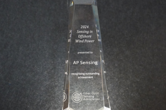
AP Sensing Won the FOSA 2024 Sensing in Offshore Wind Award
AP Sensing is honored to be recognized by the Fiber Optic Sensing Association (FOSA) for our qDoBS Method for Power Cable Monitoring.

Aug 30, 2024
Fire Detection for Rooftop, Greenfield and Floating Solar Panels
The implementation of the fiber optic LHD system for a major, globally operating food and beverage manufacturer in Thailand effectively addresses the unique challenges of fire detection in large-scale solar panel PV installations.
Jun 25, 2024
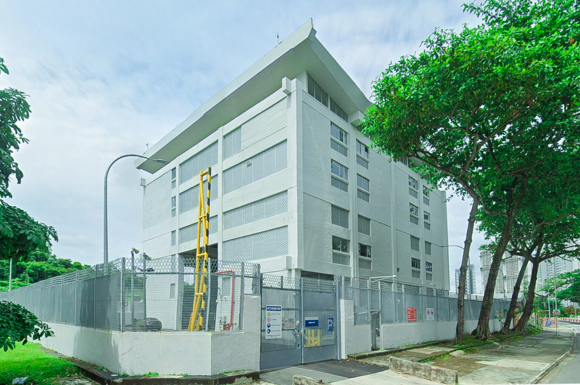
66 kV Transmission Substation Protection in Singapore
In one of Singapore’s Linear Heat Detection projects, old substations were upgraded from a conventional heat detection system to a new linear heat detection system. An AP Sensing fiber optic Linear Heat Detection (LHD) solution was selected, this project was commissioned in stages, coming to a conclusion in 2022, To date, five LHD interrogator units have been installed along a distance of 1 km in order to protect various substations.

Jun 7, 2024
AP Sensing's LHD System Used in a Cold Storage Room
A world-leading food manufacturer in Singapore was building a state-of-the-art Food Hub spanning 40,000 m². AP Sensing collaborated with a local partner to deploy 10 units of long range (10 km and 8 km) Distributed Temperature Sensing (DTS) units, each with 2 channels that are linked in a loop - meaning that it can prevent cable redundancy.

Apr 19, 2024
Bus Duct Temperature Monitoring in a Hyperscale Facility
AP Sensing deployed one fiber optic Distributed Temperature Sensing (DTS) unit with four channels; each channel monitors up to approximately four kilometers for a major American tech company for its hyperscale facilities globally, specifically for a continuous monitoring solution for the entire length of high ampacity bus ducts that emerge from UPS rooms.
Mar 7, 2024
AP Sensing Launches Pipeline Video
Find out more about how our pipeline monitoring system works and what makes it so advantageous in our brand new video.

Mar 7, 2024
AP Sensing Launches Power Cable Monitoring Video
AP Sensing’s DFOS technology continuously monitors your entire power cable infrastructure and enables network performance optimization.

Dec 12, 2023
Depth of Burial State Monitoring
In this case study, we demonstrate the effectiveness of our method by comparing the calculated DoBS results with the exposed locations determined during a Remotely Operated Vehicle (ROV) survey on the 500 kV Skagerrak4 HVDC interconnector between Norway and Denmark, conducted in August 2022.

Dec 7, 2023
AP Sensing Continues its Tradition of Giving with 2023 Christmas Donation
The focus for 2023 is on providing aid to the people of Somaliland through a collaboration with the renowned humanitarian organization CARE.
Oct 11, 2023
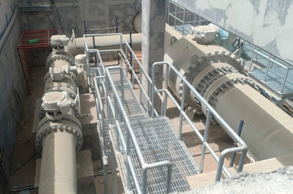
Water Transmission System – TPI & Leak Detection
In order to detect any potentially harmful Third Party Intrusion (TPI) activities in the vicinity of the buried pipelines, the owner requested the deployment of a fiber optic based Distributed Acoustic Sensing (DAS) system so that the maintenance and security teams can be enabled to stop these activities, if necessary, before the pipelines and fiber optic cables can be damaged.

Sep 20, 2023
Expand DCIM Functionality with DFOS
Dedicated data center maintenance is critical in achieving tier classification via operational availability.

Aug 31, 2023
Leveraging DFOS for Post-Perforation Production Profiling
In China, a gas field operator required a non-intrusive approach for analysis of well performance in deviated/horizontal wells, So AP Sensing's DAS and DTS were used to collect temperature and acoustic data for production surveillance.

Aug 31, 2023
Temperature Monitoring of Multiple Borehole Heat Exchangers
To enhance monitoring and optimization at Hamburg's Ministry of Urban Development and Environment a DTS system was implemented, offering continuous, high-resolution thermal data.

Aug 21, 2023
Fire Protection for Solar Farms
The rapid growth of solar energy worldwide has led to an increased need for reliable monitoring and fire detection in (PV installations. Fiber Optic LHD is a reliable tool for detecting fires on a photovoltaic installation.

Jun 19, 2023
Revolutionizing Fiber Optic Linear Heat Detection
AP Sensing's new N45-Series fiber optic LHD system is featured in the June edition of International Fire Buyer
Jun 12, 2023
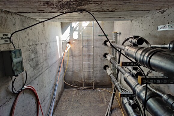
Fiber-Based Current Monitoring, Switzerland
AP Sensing, together with Brugg Cables, performed a study to measure sheath currents with the aim of electrical condition monitoring of the operator’s asset. AP Sensing’s sheath current monitoring solution (Fiberbased Current Monitoring - FbCM) using DAS for a 110 kV undergroundcable was implemented to minimize the risk of unexpected downtimes.
May 31, 2023
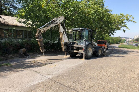
AP Sensing Performed Urban Power Cable Monitoring Using DAS & AI
AP Sensing, together with our partner Crony, completed a project in Serbia aimed at monitoring underground, urban HVAC power cables and detecting activities that pose a risk to power cables, such as road construction. AP Sensing’s Distributed Acoustic Sensing (DAS) is designed and well-suited to detect TPI events by measuring s

May 13, 2023
Wood Pellet Fire Detection
AP Sensing was featured in a Biomass Magazine article discussing the advantages of fiber optic LHD for wood pellet monitoring.

Apr 18, 2023
Earth Day & AP Sensing's 270,000 Tree Celebration
With years invested in the tree planting initiative with our partner WeForest, we have grown 270,000 trees – the equivalent of 236 football pitches.
Apr 18, 2023
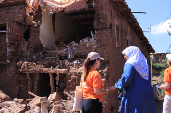
AP Sensing Extends Support to CARE's Earthquake Relief Efforts in Morocco
In September 2023 Morocco experienced a devastating 6.8 magnitude earthquake. AP Sensing responded to the immediate needs of affected communities by donating to CARE.

Apr 18, 2023
Photovoltaic Panel Monitoring
A major tech company required detection and heat monitoring solution for rooftop solar panel installation.

Apr 17, 2023
Sustained Casing Pressure Localization Using DFOS Slickline
A slickline survey utilizing DFOS was employed by Expro to identify the source of SCP; data was acquired using AP Sensing’s DTS and DAS.

Mar 27, 2023
AP Sensing Monitors Large Solar Power Plant in Abu Dhabi
AP Sensing recently completed yet another successful project commissioning for the Abu Dhabi Al Dhafra Solar Project.
Mar 22, 2023
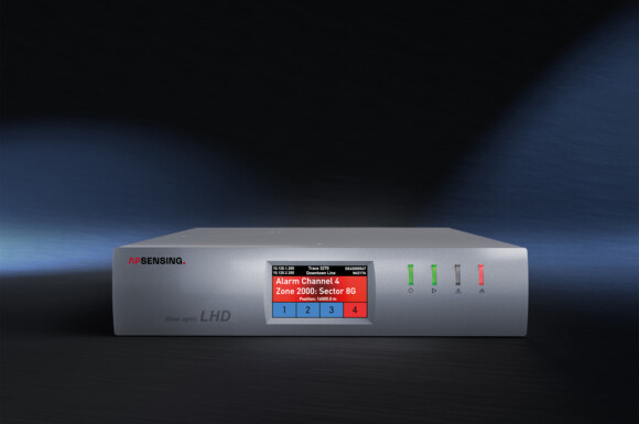
AP Sensing Launches LHD N45-Series
AP Sensing, a leading provider of fiber optic sensing solutions, is proud to unveil the launch of its third-generation fiber optic Linear Heat Detection (LHD) system - the N45-Series.

Mar 19, 2023
Continuous Bus Duct Monitoring for Data Centers in Frankfurt by AP Sensing
In order to streamline the daily maintenance process of the physical layers, AP Sensing’s Continuous Bus Duct Temperature Monitoring (CBTM) solution was retrofitted for Schneider 2000A busways spanning across switch room and the data hall.

Mar 19, 2023
Bus Duct Monitoring in a Colocation Data Center Facility at Copenhagen
AP Sensing collaborated with a local partner over multiple phases to deploy a distributed fiber optic sensing solution for the data center. Each phase deployed one DTS device with four channels, each device monitors up to 2 km per channel. Our speciality fiber optic sensor cable was fitted along the bus ducts using customized cable clips.

Jan 19, 2023
Below Ballast Scan (BBS) in Action—A Case Study Compilation
The collaboration between AP Sensing with its sensitive DAS technology, and Sercel with its enhanced solution for geophysical near surface evaluation provides insights of the underground geology along rail tracks. The world’s first BBS solution revolutionizes train track condition monitoring and can analyse ground conditions up to 50 m below the ballast.

Nov 15, 2022
AP Sensing Plants 3 Trees Per Employee Every Day
Coming upon the 3-year anniversary since our tree planting initiative began, AP Sensing has planted 166,000 trees.

Nov 7, 2022
Detecting Leaks with Fiber Optic Sensing
In the article, AP Sensing’s Dr. Alex de Joode discusses the applicability of distributed fiber optic sensing-based pipeline leak detection software under API 1130 and API 1175.
Oct 10, 2022
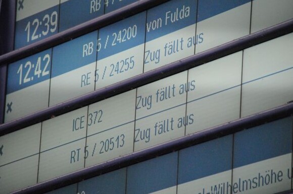
Safeguarding Critical Railway Infrastructure with Distributed Fiber Optic Sensing
AP Sensing's Distributed Fiber Optic Sensing (DFOS) solutions help detect, locate, and identify Third Party Intrusion (TPI) events affecting rail infrastructure. The detection and localization of abnormal activities is conducted in real time, enabling immediate countermeasures.

Aug 16, 2022
How AP Sensing is Making Cities Smarter with Fiber Optic Sensor Technology
AP Sensing was featured in Europolitan magazine to discuss how fiber optic sensing technology is making cities smarter.
Jun 2, 2022
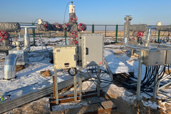
Gas Storage Monitoring in China
AP Sensing, alongside our local partner, provided a downhole oil and gas monitoring solution to CNPC Daqing Oilfield in China.

May 12, 2022
AP Sensing Performs Successfully in Tunnel Fire Tests
The real-life case of a car fire was simulated in multiple fire safety tests prior to the opening of the Kriegsstrassentunnel in Karlsruhe, Germany.

Apr 10, 2022
Safeguarding Critical Infrastructure with Distributed Fiber Optic Sensing
AP Sensing's DFOS solutions help to detect, locate, and identify third party intrusion on pipelines, power cables or telecommunication infrastructure.
Feb 9, 2022
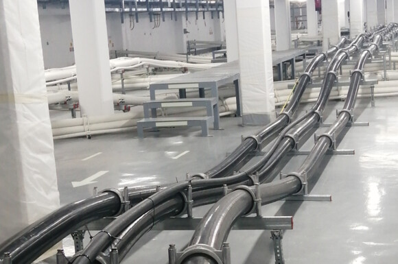
400 kV Power Cable Circuit Monitoring by AP Sensing
AP Sensing was recently selected to monitor a 400 kV power cable loop for EWA from Hidd to Riffa Grid Stations, located in the Kingdom of Bahrain. The power cable circuit includes a subsea section, and is monitored from both ends of the circuit.

Jan 27, 2022
500 kV HDVC TPI & Power Cable Monitoring
AP Sensing’s Distributed Acoustic Sensing (DAS) technology was recently deployed by Korean Electric Power Corporation (KEPCO) to monitor the power cable link. The asset is a 500 kV HVDC transmission line, approximately 35 km in length. KEPCO decided to deploy AP Sensing’s DAS to monitor the asset and receive alerts in case of Third Party Interference (TPI) activities.

Jan 8, 2022
Detailed S-wave Velocity Structure of Sediment & Crust
AP Sensing’s DAS technology was essential in obtaining insights on S-wave velocity structure of sedimentary layer and uppermost crust.

Dec 1, 2021
Riyadh Metro Tunnel Fire Detection
AP Sensing was chosen to monitor this very prestigious infrastructure with our fiber optic Linear Heat Detection (LHD) solution.

Dec 1, 2021
AP Sensing Monitors Prestigious Saudi Arabian Tunnel
AP Sensing was selected by KAFD to monitor these road tunnels using our Fiber Optic LHD monitoring solution.

Nov 25, 2021
Kolkata Underground Metro Monitoring
In cooperation with our local partner, AP Sensing was chosen to commission our Linear Heat Detection (LHD) technology on a 6649 meter underground railroad line between the stations of Phoolbagan and Sealdah.
Nov 17, 2021
AP Sensing Launches Fire Detection Video
Our LHD technology provides continuous, maintenance-free heat detection and monitoring, even in harsh environments.
Nov 8, 2021
Third Party Intrusion & Power Cable Monitoring
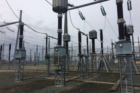
AP Sensing’s technology was deployed by RTE to monitor a 225 kV underground power cable link located in the west of France. The link is approximately 39 km long and monitored for Third Party Intrusion (TPI) activities plus cable faults using our Distributed Acoustic Sensing (DAS) system, as well as hotspots using our Distributed Temperature Sensing (DTS) system. The power link installation is surrounded by frequent agricultural activities that pose no harm to the cable. To mitigate the risk of increased false alarms from these activities, similar events were simulated to test the system based on soil mixing and harvesting agricultural machines.

Oct 29, 2021
Fire Friday #8: Redundancy
System configuration and redundancy plays a pivotal role in Linear Heat Detection (LHD)'s reliability.
Oct 22, 2021
Fire Friday #7: Quality & Reliability
We at AP Sensing have therefore designed our LHD products for performance, paying special attention to reliability and quality during the development phase.

Oct 21, 2021
The Digital Twin Acquires a New Nervous System
With the help of Digital Twins, operators are trying to achieve major efficiency gains. Using the pre-existing trackside infrastructure and cables of Deutsche Bahn, AP Sensing’s DFOS technology is used to collect live data along the track.
Oct 15, 2021
Fire Friday #6: Harsh Environments
AP Sensing fire products are rated intrinsically safe, certified by ATEX and IECEx, and can be safely used in the most challenging and hazardous environments.

Oct 8, 2021
Fire Friday #5: Certifications
As a manufacturer particularly committed to fire detection, AP Sensing offers the most comprehensive portfolio of certifications, in order for our customers to receive the highest level of system reliability and performance.

Oct 1, 2021
Fire Friday #4: Radiant Heat
Our sensor cables are specifically optimized to detect thermal radiation and are sensitive to both radiation and convection. This has been confirmed in many fire tests.
Sep 24, 2021
Fire Friday #3: Channels
One of the advantages of fiber optic Linear Heat Detection (LHD) is not only the comparatively long range, but also the possibility of connecting multiple sensor cables.

Sep 23, 2021
Deutsche Bahn Cable Duct Fire Tests
AP Sensing recently conducted trackside fire trials with the German rail operator, Deutsche Bahn! The trials took place approximately 45 km outside of Berlin in Michendorf, Germany, and were carried out by the local fire department.

Sep 17, 2021
Fire Friday #2: Spatial Resolution
AP Sensing’s LHD system allows a freely configurable spatial resolution in order to adapt the system to actual project demands, also considering other parameters.

Sep 15, 2021
Ma’aden Phosphate Conveyor Monitoring
MA’ADEN (Saudi Arabian Mining Co.) sought out a solution to protect one of its conveyor belts, and AP Sensing’s fiber optic LHD solution was selected.

Sep 10, 2021
Fire Friday #1: Linear Heat Detection Response Time
The alarm parameters in AP Sensing's LHD system are freely configurable, but we offer sets of alarm parameters that have been tested by reputable institutes such as UL, FM and the VdS. This gives our customers the assurance to find an optimal balance between fast response time and false alarm resilience.

Jul 20, 2021
Austrian Rail Operator Runs Successful Pilot Project with AP Sensing after Fire Incident
The rail operator, ÖBB Infrastructure, considered various technical alternatives for the monitoring of high voltage cables and chose AP Sensing’s Distributed Temperature Sensing (DTS) system through our partner Honeywell. Our system was tested in a long-term pilot project in Linz.

Jul 6, 2021
Selection Criteria for Pipeline Leak Detection Methods using Distributed Fiber Optic Sensing
Distributed Fiber Optic Sensing (DFOS) has expanded current pipeline leak detection technologies (LDS), providing a significant set of new capabilities. This paper briefly reviews the main types of DFOS technologies used for pipeline monitoring.
Jun 21, 2021
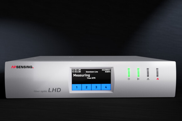
AP Sensing’s LHD: A Success Story Made in Europe
AP Sensing’s LHD: A Success Story Made in Europe - An Interview with European Sales Manager Daniel Gerwig

Jun 4, 2021
Sulfur Pipeline Flow Assurance
AP Sensing’s DTS solution was selected to monitor the pipeline temperature with 1°C temperature and 1 m spatial resolution. AP Sensing was selected due to our pipeline expertise, project management capabilities, design proposals and the quality and reliability of our DTS systems.

Jun 4, 2021
Crude Oil Pipeline Leakage Detection
Mittelplate is Germany‘s largest oilfield and is located in the ecologically-sensitive Wadden Sea. AP Sensing's DTS device was installed to monitor the full eight kilometers of pipeline between the island and the mainland.

May 28, 2021
Tension Ring and Tank Wall Monitoring
AP Sensing was selected to provide tension ring and tank wall monitoring for maximum asset protection by GPS Chemoil.

May 20, 2021
AP Sensing Monitors Prestigious Middle Eastern Projects
One of the applications for which AP Sensing is known as the market leader in the Middle East and Africa (MEA) region is linear heat detection with our N4387B Linear Heat Series.

Apr 22, 2021
AP Sensing Performs Cable Theft Monitoring for DB
In 2018, AP Sensing began cable theft trials with the Deutsche Bahn in Berlin. Distributed Acoustic Sensing (DAS) technology uses a fiber optic cable as a continuous sensor that detects acoustic energy.

Apr 15, 2021
Kanda Biomass Energy Introduces DTS for Fuel Conveyor in Energy Plant
Kanda Biomass Energy selected a DTS system developed by NK Systems and AP Sensing their biomass power plan in Kyushu, Japan.
Apr 5, 2021
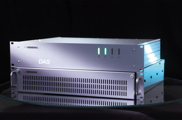
AP Sensing Releases Next Generation of Acoustic Sensing Technology
AP Sensing’s fifth Generation DAS, specifically, utilizes acoustic vibrations along the fiber optic cable in order to detect and precisely locate events in real time such as pipeline leaks, high voltage power cable faults, Third Party Interference (TPI) activities, or other abnormal events.

Mar 16, 2021
AP Sensing Presented a FOSA Webinar on Rail Monitoring
The webinar demonstrates the use of modern AI technologies as Neuronal Networks in combination with DFOS technologies for applications in rail monitoring.

Mar 12, 2021
AP Sensing's LHD Protecting Cable Tunnel in Al Rayyan
AP Sensing fiber optic LHD solution was selected as a reliable solution for fire detection along the tunnels. This solution must function alongside other monitoring technologies and interface with the local Fire Alarm Control Panel (FACP).

Mar 8, 2021
Power Cable Fault Detection & Location Analysis
For large power cable assets such as subsea cables, windfarm export cables or HV onshore transmission cables, finding cable faults rapidly is crucial to minimizing downtimes caused by these faults. Fiber optic Distributed Acoustic Sensing (DAS) is a key enabler for this task, as it pinpoints the exact location of an occurring cable fault if permanently installed or post-fault during thumping/flashover generation campaigns. The following examples summarize AP Sensing’s recent experience providing fault-finding services (both online and offline) with our DAS system.

Feb 9, 2021
T&D network chooses AP Sensing's DTS + RTTR
AP Sensing’s Distributed Temperature Sensing (DTS) solution was selected in order for the T&D to maximize its assets and take advantage of the related operational cost savings with a noticeable improvement in the network’s efficiency.

Feb 5, 2021
380 kV Underground Power Line Monitoring performed by AP Sensing
AP Sensing was selected by Brugg Kabel AG, a Swiss cable manufacturer, and SwissGrid, a Swiss transmission system operator, to monitor a newproject at the Gäbihübel in Switzerland. For this challenging task, a 12-channel Distributed Temperature Sensing (DTS) solution from AP Sensing was selected.

Jan 18, 2021
AP Sensing-FOCUS Magazine 2021 Top Employer
FOCUS, has ranked AP Sensing as a top medium-sized employer in Germany for the 4th time in a row!

Jan 1, 2021
AP Sensing Technology Deployment at World’s First Underwater Roundabout
In this project, we are monitoring the entire tunnel utilizing three N4387B interrogator units, with all data managed by our SmartVision software.

Dec 9, 2020
AP Sensing Continues its Tradition of Giving with 2020 Christmas Donation
The focus for 2020 is on providing aid to the people of Syria through a collaboration with the renowned humanitarian organization CARE.

Nov 23, 2020
Critical Infrastructure & Security Month
AP Sensing monitors various types of critical infrastructure worldwide and believes the protection of these assets is of the utmost importance.

Nov 16, 2020
Fibre Optic Technology- Beyond Traditional Linear Heat Detection
Distributed Fibre Optic Sensing (DFOS) technology is simple to install and offers significant advantages compared to other monitoring technologies or point sensors.
Nov 9, 2020
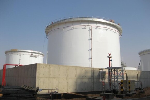
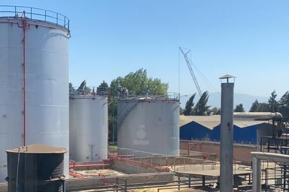
AP Sensing Monitors Alcohol Tanks in Chile
AP Sensing's Fiber Optic Linear Heat Detection (FO LHD) solution was selected to monitor a tank farm in the Panimex Quimica chemical plant in Chile. The project specifications stipulated one tradition LHD system per tank, but due to poor past experiences with false alarms and continuous maintenance, the operator chose AP Sensing's FO LHD. An additional benefit is only one FO LHD unit is needed to monitor all the tanks.
Sep 30, 2020
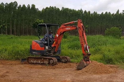
Safeguarding a 27 km Natural Gas Pipeline
A natural gas pipeline operator in Thailand sought out a solution to protect its pipeline from Third Party Interference (TPI). Previously, employees had been expected to patrol the pipeline 24/7, but a more effective solution was needed. The client conducted various trials in 2019 to compare AP Sensing to competing systems and was very happy with the results of AP Sensing's Distributed Acoustic Sensing (DAS) system.
Sep 15, 2020
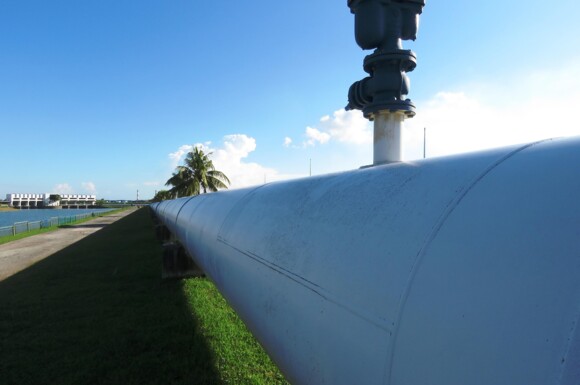
Aramco Approves New Fibre Optic Pipeline Leak Detection Technology
Distributed Fibre Optic Sensing Systems by AP Sensing offer improved performance and are installed on Aramco’s crude oil pipelines, Dr Alex De Joode, Head of AP Sensing Pipelines and Terminals Business Unit, tells OGN.

Sep 8, 2020
Tree Planting Project Update
AP Sensing’s partner WeForest recently released its mid-year report for the Mt. Mulanje project in Malawi. This is one of WeForest’s newest projects, and the project that AP Sensing began contributing to in 2019 by planting 100 trees for every fiber optic sensing interrogator unit (DTS/DAS/DVS) that we sell.

Aug 20, 2020
AP Sensing Selected to Monitor New Metro System
In parallel with the launch of the new Doha Metro system in 2019, AP Sensing began monitoring its railway tunnels with our Linear Heat Detection (LHD) solution. 128 km of the metro system is monitored by 16 multi-channel Distributed Temperature Sensing (DTS) units, 132 km of fiber optic cable and AP Sensing's SmartVision software.
Aug 6, 2020
Preventative Conveyor Belt Protection in Chile
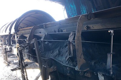
Codelco, the National Copper Corporation of Chile, sought out a solution for real-time monitoring at one of its operations, a copper refinery and processing plant. The client pursued our fiber optic Linear Heat Detection (LHD) solution in order to implement an onsite system that is preventative and not simply reactive.
Jun 18, 2020
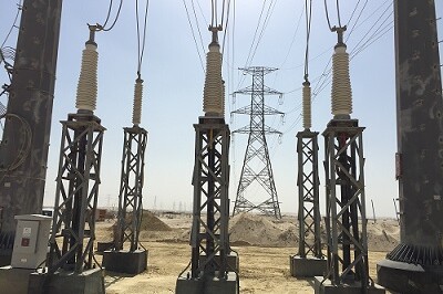
115kV Underground Power Cable Monitoring Saudi Arabia
Saudi Electricity Company (SEC) selected AP Sensing for a project monitoring two 115kV power circuits. Our technology provides not only the thermal profile of the power cables, but also insights into the actual conductor temperature and transient statuses with our Real Time Thermal Rating (RTTR) engine.
Jun 4, 2020
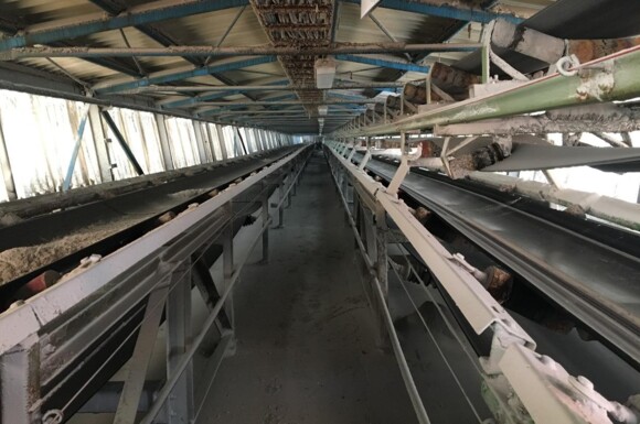
Above-Ground Conveyor Belt Monitoring in Germany
AP Sensing is monitoring conveyor belts at the largest salt production site in Germany. In total, 22 conveyor belts are monitored with 11 LHDdevices spread across the entire site.

May 26, 2020
Meet AP Sensing Video Series
Who are the people behind AP Sensing? We are excited to launch a new video series giving you a chance to “meet” members of our team working across the world, remotely at home & at our German headquarters.
May 13, 2020
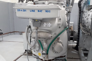
Industrial Power Cable Monitoring Pakistan
AP Sensing is monitoring a 132 kV underground transmission cable for Karachi Electric. This cable experiences greater loads than nominal lines, as it feeds energy to a steel mill with high energy throughputs and frequent consumption cycles.
May 7, 2020
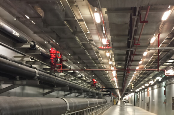
Electrical Power Cable Tray Protection
At the Princess Nourah Bint Abdulrahman University, AP Sensing’s Linear Heat Detection (LHD) solution is monitoring the underground electrical cable galleries of the campus.
May 6, 2020
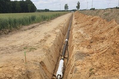
Wet Oil Pipeline Monitoring Utilizing Advanced Leakage Detection Techniques
AP Sensing is monitoring a complex project involving two buried, wet oil pipelines utilizing Distributed Temperature Sensing (DTS) and Distributed Acoustic Sensing (DAS) systems for leak detection for our customer, Wintershall-Dea.